Overview
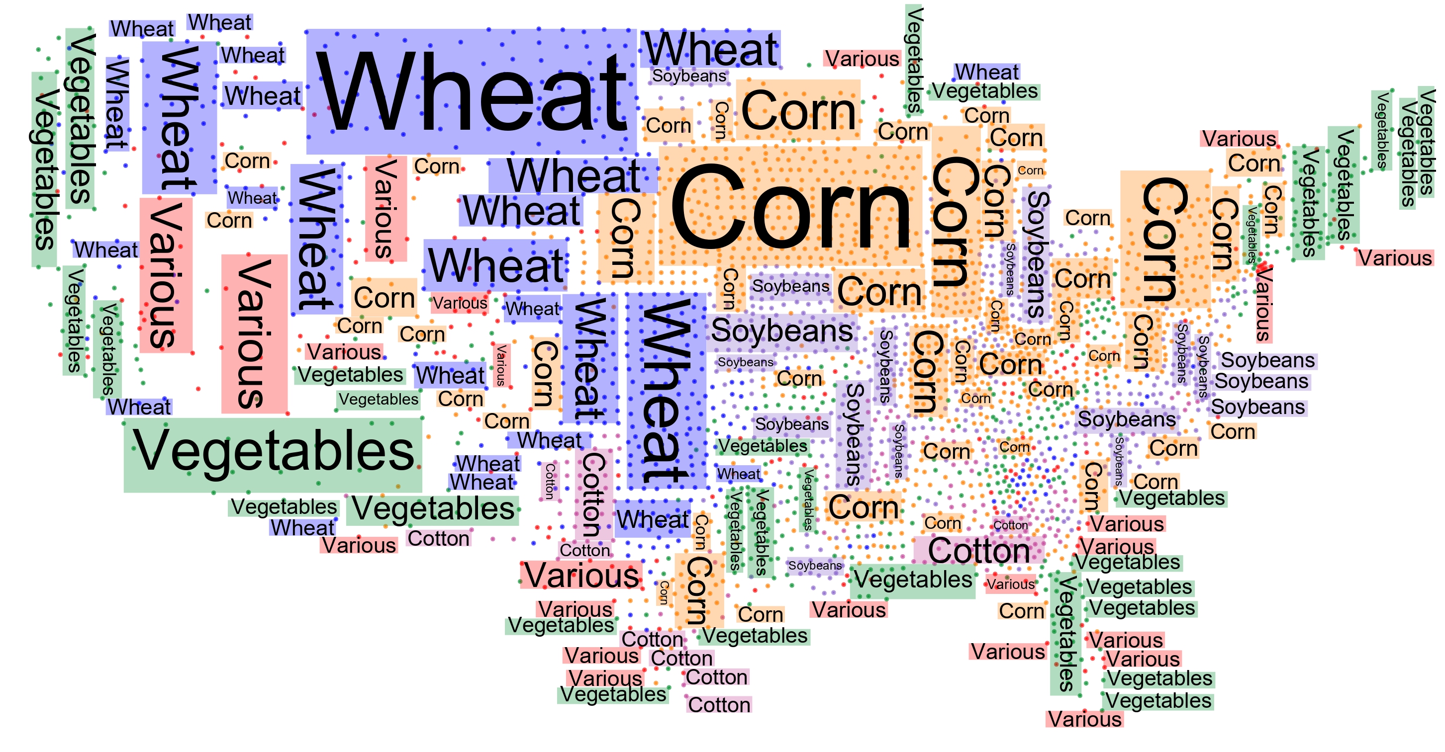
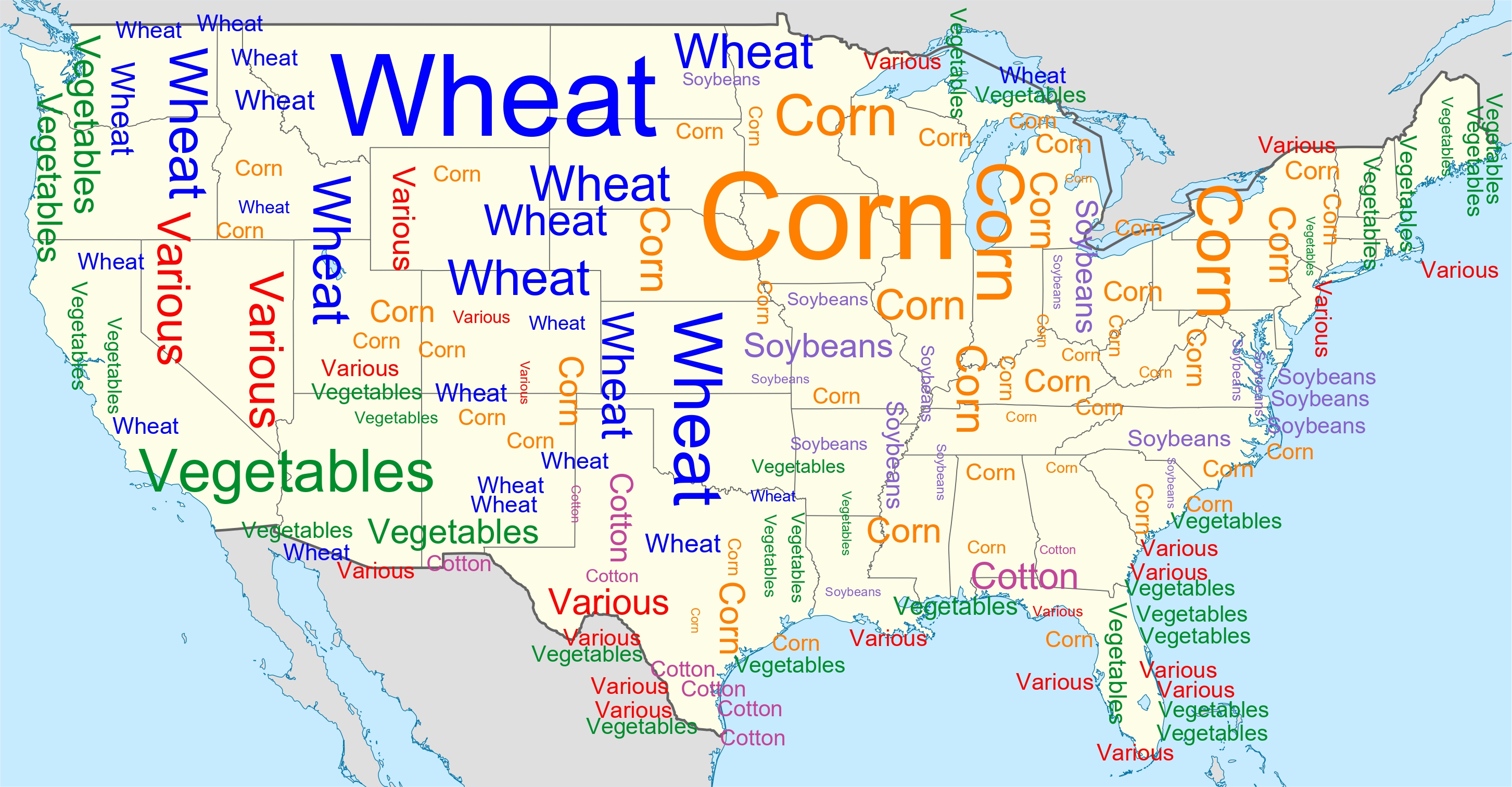
Overview Point feature labeling is a classical problem in cartography and GIS that has been extensively studied for geospatial point data. At the same time, word clouds are a popular visualization tool to show the most important words in text data which has also been extended to visualize geospatial data (Buchin et al. PacificVis 2016). We study a hybrid visualization, which combines aspects of word clouds and point labeling. In the considered setting, the input data consists of a set of points grouped into categories and our aim is to place multiple disjoint and axis-aligned rectangles, each representing a category, such that they cover points of (mostly) the same category under some natural quality constraints.
In our visualization worbel, we then place category names inside the computed rectangles to produce a labeling of the covered points which summarizes the predominant categories globally (in a word-cloud-like fashion) while locally avoiding excessive misrepresentation of points (i.e., retaining the precision of point labeling).
This is the open source project GeoWordle—a generator of geo word cloud with point label aggregation, developed at the Institute of Logic and Computation, TU Wien, Vienna, Austria.
Licence
This project is under MIT licence.
Reference
If you want to know more about our implemented algorithms, please refer to our papers:
Worbel: Aggregating Point Labels into Word Clouds
Sujoy Bhore, Robert Ganian, Guangping Li, Martin Nöllenburg, Jules Wulms
Advances in Geographic Information Systems (SIGSPATIAL’21), pages 256–267, 2021, ACM.
[bibtex] [pdf] [doi]
Worbel: Aggregating Point Labels into Word Clouds
Please acknowledge our work if you publish your result using our algorithms or code.
Download
Source code and benchmark instances (available in this github repository)
Benchmark data generator for point features (available in this github repository)
Support
Please write us an Email if you have questions.
We are glad to get any comments and error reports.
A random instance generator is available upon request.
Acknowledgments
GeoWordle is part of the project “Human-Centered Algorithm Engineering: Graph and Map Visualization” supported by the Austrian Science Fund (FWF) under Grant P31119, 31336 and Y1329.